
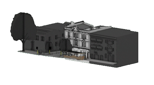
Digitise your building asset.
√ Verified spatial data intelligence
√ Digital Assets delivered with accuracy and speed
√ Reliable and Scalable
√ Endless Applications
We capture and deliver verified digital models of building conditions to extract accurate data and value adding information.


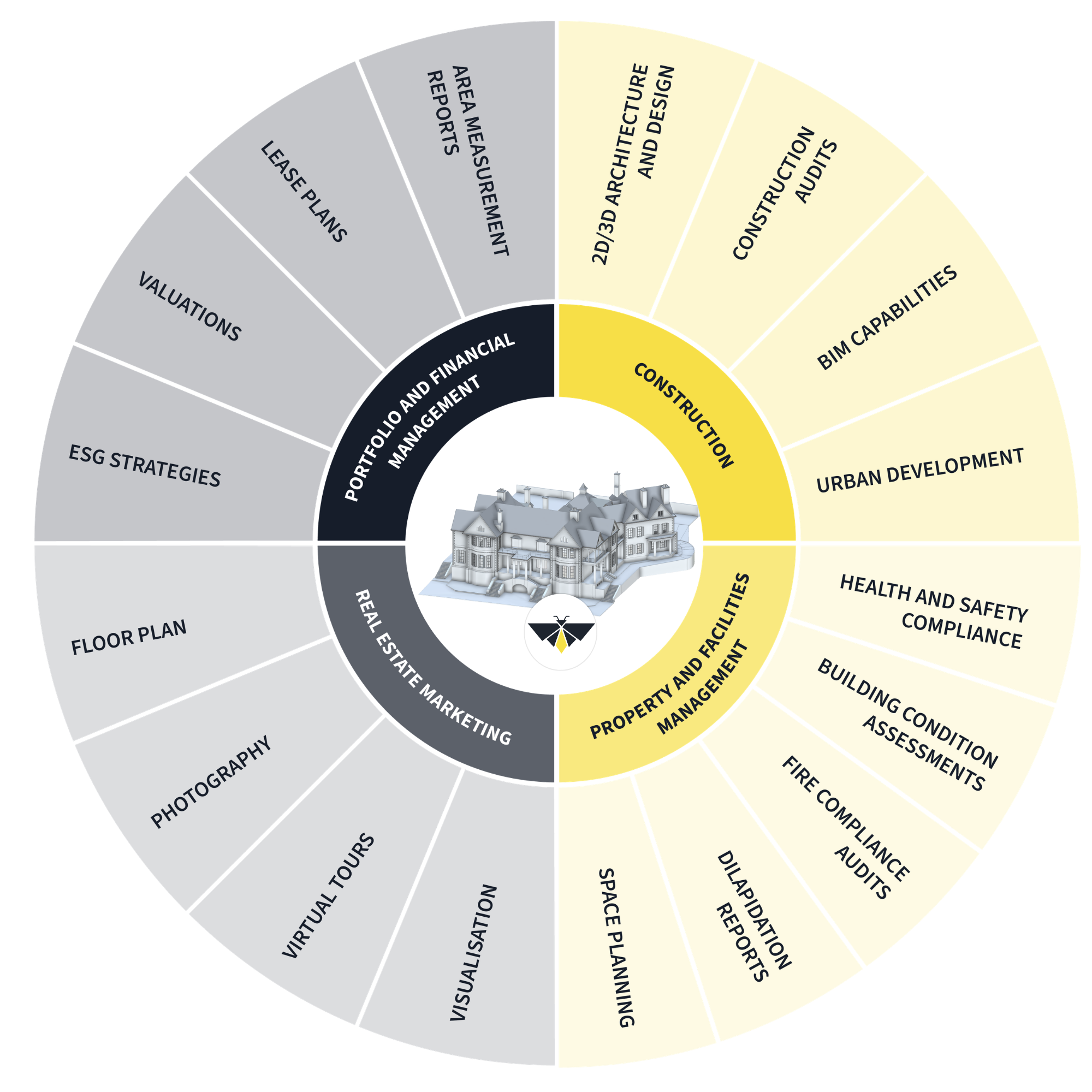


OUR SERVICES
Digitise your building with accuracy and speed.
From initial site capture, to final data delivery, we offer a seamless workflow tailored to your project's requirements.
Whether you're planning, designing, or building, our digital surveying services provide the reliable data foundation you need to move forward with confidence.
-
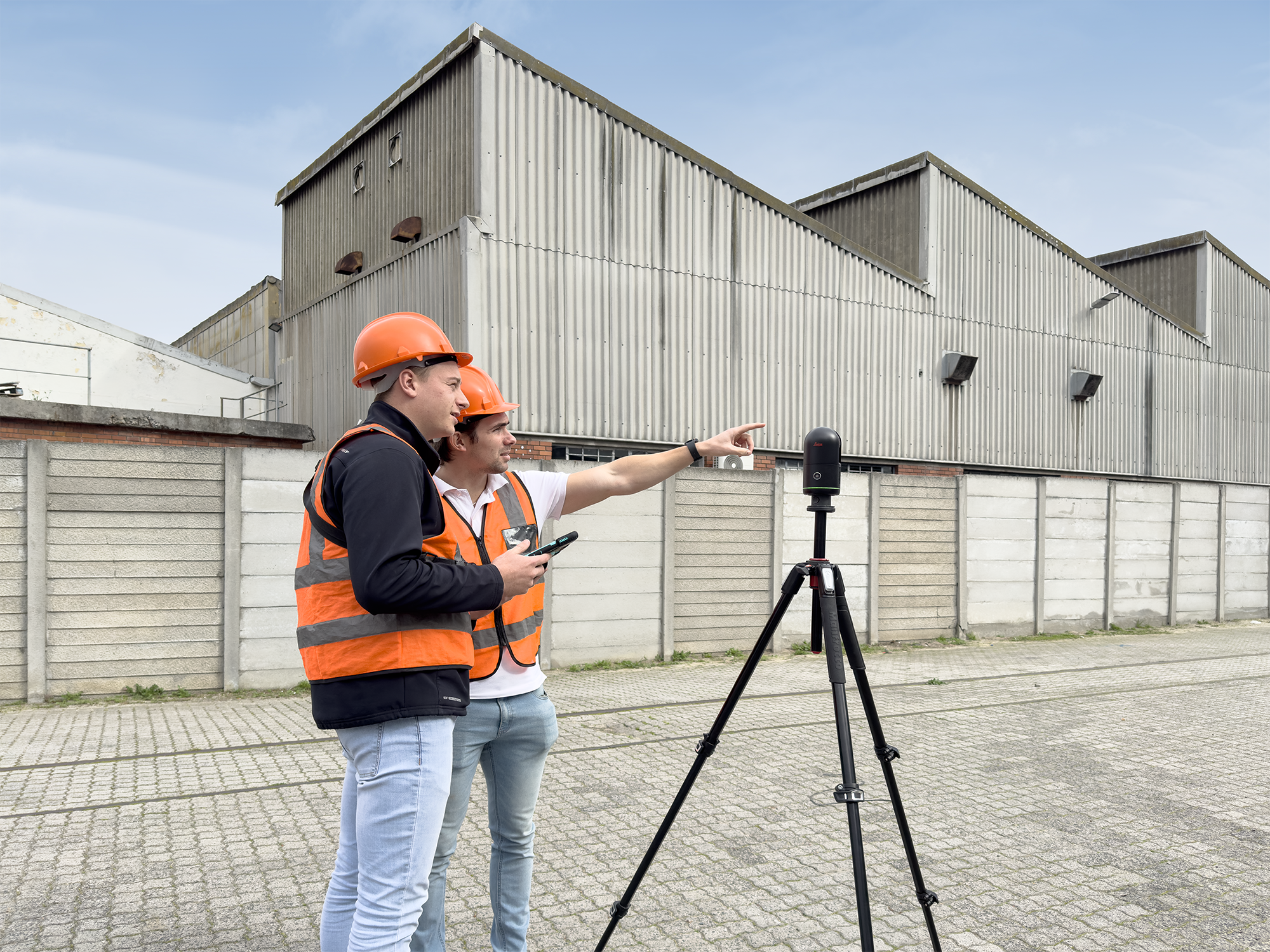
LiDAR Scan Technology
Drone Technology
Photogrammatry
-
Description text goes here
-
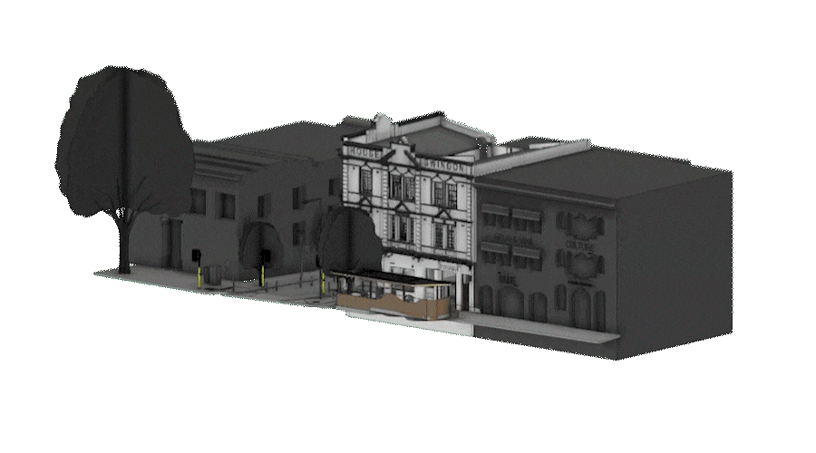
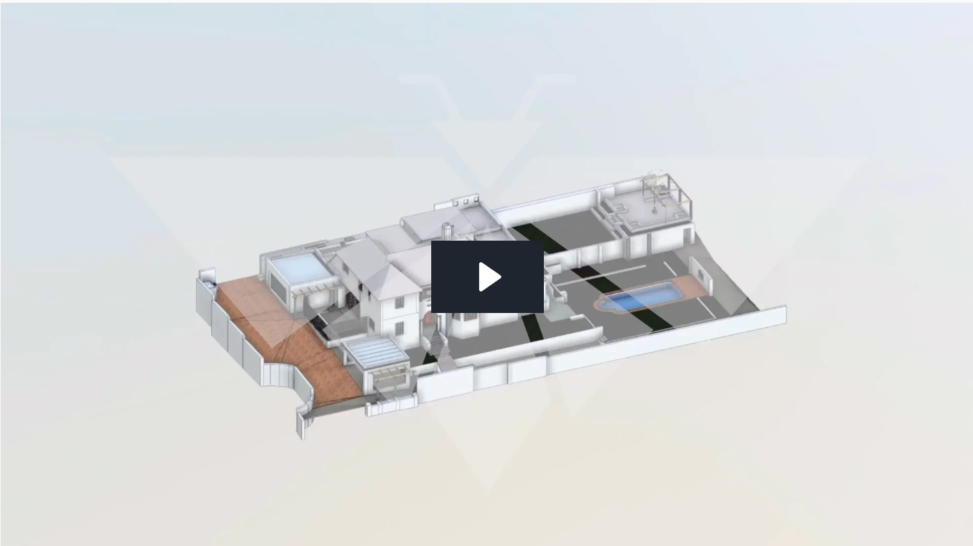
3D Core lDigital Mode
-
Item description
-
![]()
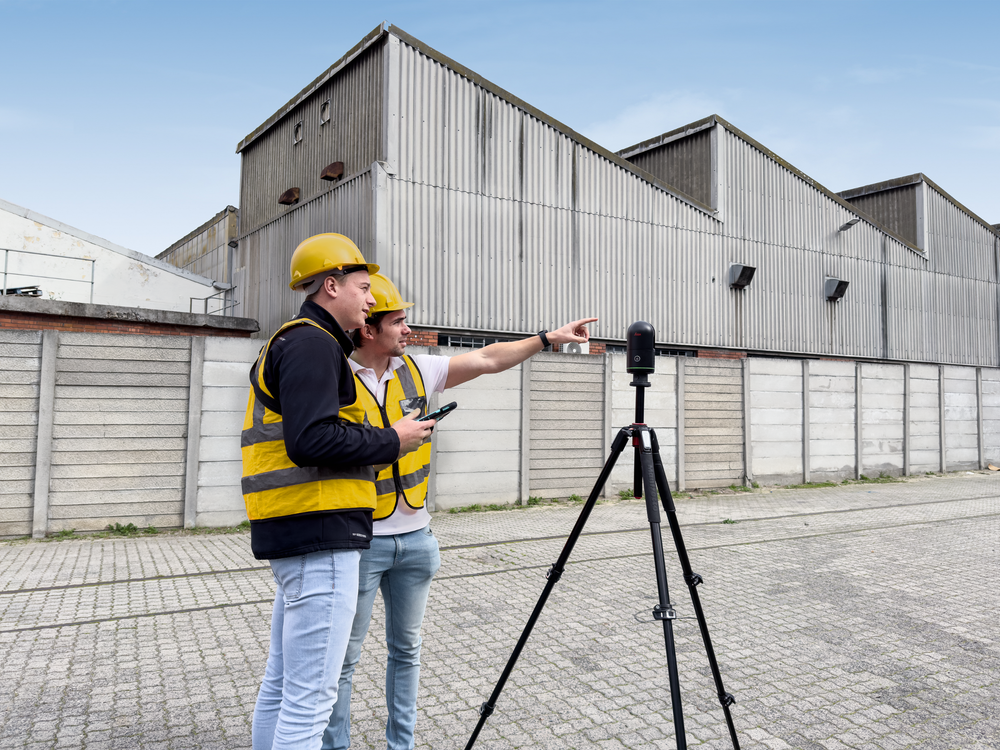
Digital Reality Capture
Our professional RICS certified Digital Surveyors, will use advanced technology to scan your building conditions.
-
![]()
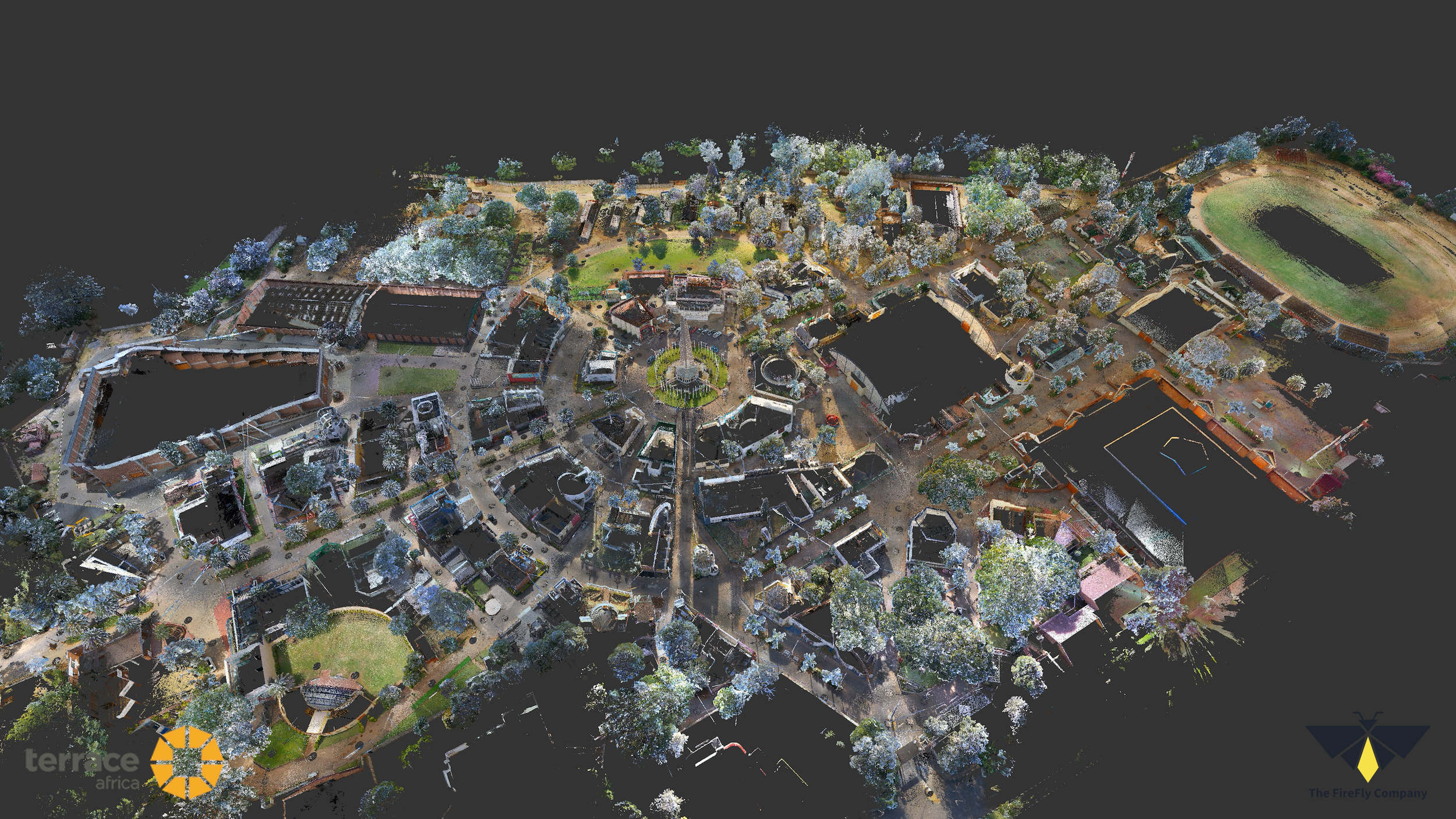
Registered Point Cloud
We provide you with Registered Point Cloud Reports and a Flythrough video of your digitised building.
-
![]()
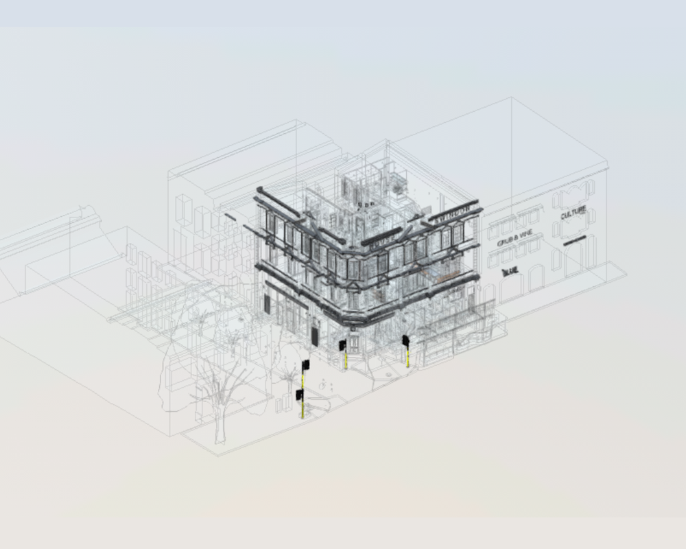
3D Core Digital Model
What should we know about the services you provide? Better descriptions result in more sales.
-
![]()
Verified Plans in 2D
2D Plans of your Building including Sections and Elevations, Site Information Drawings, Reflected Ceiling Plans.

Services to scan and digitise your building asset with verified measurements.
-
![]()
Digital Reality Capture
Our professional RICS certified Digital Surveyors, will use advanced technology to scan your building conditions.
-
![]()
Registered Point Cloud
We provide you with Registered Point Cloud Reports and a Flythrough video of your digitised building.
-
![]()
3D Core Digital Model
What should we know about the services you provide? Better descriptions result in more sales.
-
![]()
Verified Plans in 2D
2D Plans of your Building including Sections and Elevations, Site Information Drawings, Reflected Ceiling Plans.
Extract valuable data and information customised for your needs.
√ Smarter Decision Making over the building life-cycle
√ Faster turnaround
√ Data and Information at any stage
√ Reduce Site Visits
√ Comprehensive Documentation
-
Area Measurement Report
Precint Mapping
Site Information Drawing
Accurate 2Ds Plan of as-built conditions
-
Up to date Building plans
Area Measurement Verification
MEP modelling services
Precinct mapping / Master plan
-
Lease Reports and Certificates
Floorplan
Optimisation of Occupancy
Visualisation Tools
-
2D Plans
Measurement Survey
Marketing Assets
-
Facilities Management
-
Visual Record
Floor Pl
Schedule of Conditions
Accurate Measurements
Protect your building with a Visual Record of assets.
A detailed, visual record of your property, digitally capturing spaces, assets, and infrastructure in high resolution.
> Facilities layout and equipment mapping
> Asset Tagging for Insurance
> Special Condition Reporting

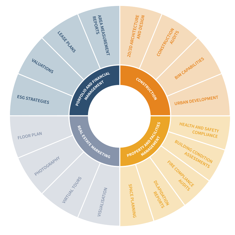
Products
Marketing and Visualisation
A detailed, visual record of your property, capturing spaces, assets, and infrastructure in high resolution to support claims, compliance and facilities management.
Protect your building with a verified Visual Record of your asset.
-
Facilities Management
Maintenance
-
Property Condition Reporting
What should we know about the services you provide? Better descriptions result in more sales.

-
Asset Tagging
What should we know about the services you provide? Better descriptions result in more sales.
OUR SERVICES
Digital Capture and Modelling Services
From initial site capture, to final data delivery, we offer a seamless workflow tailored to your project's requirements.
Whether you're planning, designing, or building, our digital surveying services provide the reliable data foundation you need to move forward with confidence.
LiDAR Scanning
Our professional Digital Surveying Service to digitally scan as-built conditions of your property.
Registered Point Cloud
We provide you with Point Cloud Registration reports and fly-through videos of your digitised property.
3D Revit Modelling
Select the level of detail for your 3D model: Basic, Standard or Detailed.
2D Drawings
• 2D CAD Plans
• Sections & elevations
• Reflected ceiling plans
• Site information drawings
Bespoke Assets
Customised deliverables on request:
• Area Measurement Verification
• Deviation reports
• Summary Of Areas
• Lease Plans
• MEP modelling services
• Schedule of Conditions Reports
• Precinct mapping / Master plan
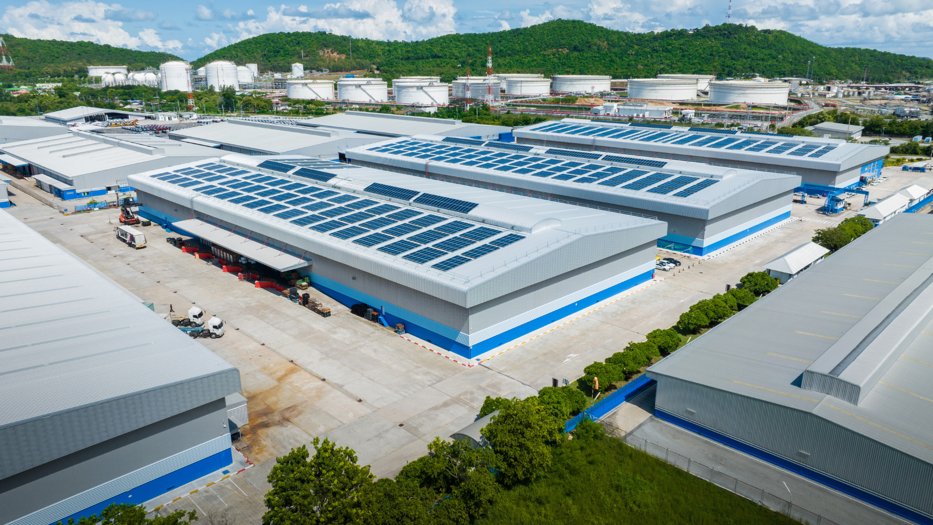
Transform Real Estate into verified Digital Assets
Digitise your existing building and site conditions with speed, quality, and accuracy.
We combine advanced 3D scan technology, including LiDAR, photogrammetry, and drone capture, to reduce surveying time by up to 50% and deliver verified digital building data. Our end-to-end solution empowers smarter, data-driven decisions, minimises project risk, and enhances long-term operational efficiency.

We are global
We have delivered projects in over 10 Countries across Africa, USA, UAE and the UK
+500 projects
Across Retail, Hospitality, Industrial, Residential, Maritime and Education sectors
Digitisation Experts
We have digitised over 70 million sq ft valued at over $150m worth of Real Estate
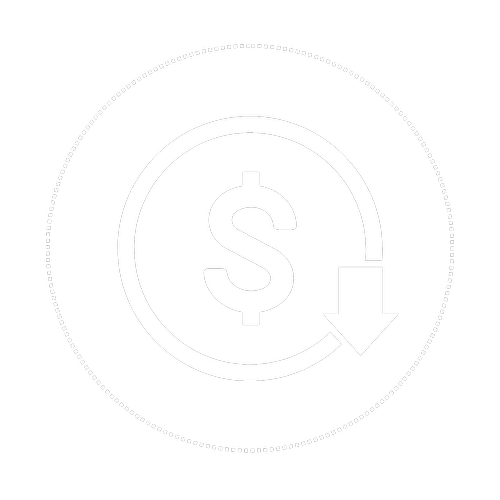
Efficient
Reduce time spent on-site and long term costs over the life-cycle of a building
We are global
We have delivered projects in over 10 Countries across Africa, USA, UAE and the UK
+500 projects
Across Retail, Hospitality, Industrial, Residential, Maritime and Education sectors
Digitisation Experts
We have digitised over 70 million sq ft valued at over $150m worth of Real Estate
Efficient
Reduce time spent on-site and long term costs over the life-cycle of a building
What we do
Visual Property Documentation
We capture a detailed, visual record of your property, capturing spaces, assets, and infrastructure in high resolution to support claims, compliance, maintenance, and lifecycle management.
360° walkthroughs for internal records
Property Condition documentation for insurance claims
Asset tagging with location references
Facility layout and equipment mapping
What we do
Marketing and Visualisation
Immersive visuals to showcase and promote your property.
Professionally staged 3D virtual tours
High-resolution stills and drone footage
Interactive floorplans
Rendered walkthroughs for unbuilt or in-progress spaces
Useful for Property Marketing, Event Planning, Sales presentations, Investor communications.
Visualisation
We offer Architectural visualisations, Virtual staging, 3D Rendering >
Visual Record
We create an Immersive digital walk through. We also offer condition tagging for Inspection Tours.
Professional Photography
Professional Photography with premium editing including removals and enhancements.
Use cases
Who we work with
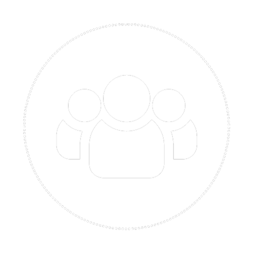
Property Owners / Developers
Commission 3D Revit Modelling with 2D CAD plans of current conditions to make decisions from acquisition, development and construction, to ongoing portfolio management.
Architects / Quantity Surveyors / Engineers
Use accurate 3D Digital Model of current as-built conditions with 2D drawings to initiate design and development phase with their client.
Interior Designers / Real Estate Agencies
Use immersive visualisation techniques to bring a vision to life for their client that is beautifully represented and accurate to the finest detail.
Insurance and Valuations
Accurate scan data used to valuate current conditions, provide Visual Records for Inspections and condition tagging.
Digital Twins can help you unlock efficiency gains throughout the life cycle of a building from the design to the optimisation systems in operation and life extension of critical infrastructure.
With 30% of global emissions generated by buildings, Digital Twins play a pivotal role to enable our path to net zero.
Achieve ESG, sustainable development goals
Use cases

Enhance Sustainability
Energy efficiency data information for accurate analysis, reporting and decision making.
Smart Cities and Communities
Enabling sustainable urban planning within existing communities.
Industry Standards
Influence policy and regulation. Standardise 3rd party construction verification. Introduce Net Leasable Area Certificate as industry standard.
Digitisation
Holistic data sets of buildings to unlock additional opportunities that support SDG goals.
Future proof buildings
Model and simulate design choices to increase the lifespan of a building for 50+ years. Responsible consumption of materials and reduced waste.
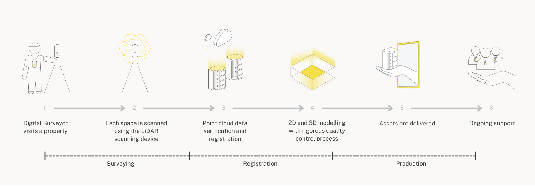
Our rigourous process from capture to completion
How it works
Quality control is embedded in our culture. An integral part of our commitment to complete an exceptional product that drives value and efficiency to meet the requirement of each project deliverable.
We have delivered 500 + projects globally
End Clients

